WHAT YOU NEED TO KNOW
Useful information about technical fundamentals, configuration and use of SAPOS® services
Below, we would like to provide you with some background information about the SAPOS® services and how to use them. If you have any questions, please do not hesitate to contact us.
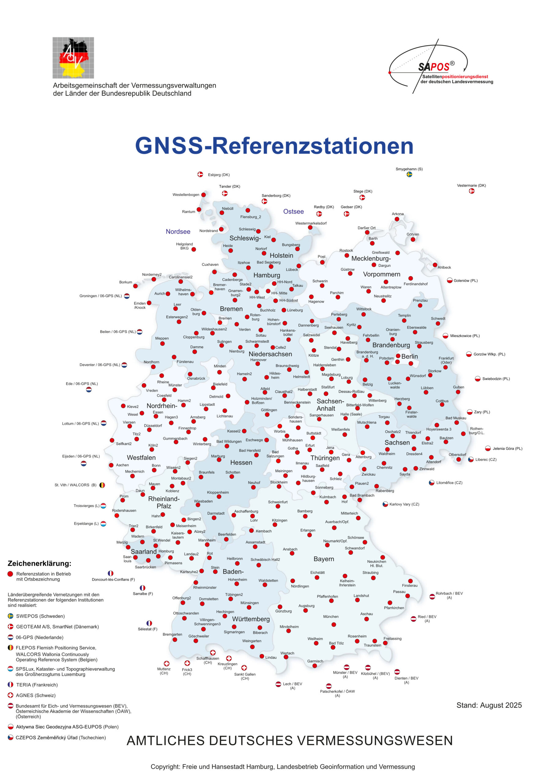
The SAPOS® service is based on a network of around 270 GNSS reference stations operating continuously in the federal states, as well as additional reference stations in Germany’s neighbouring countries.

To connect to SAPOS® HEPS, you must configure your GNSS receiver. This includes the address of the NTRIP caster, the mount point and the NTRIP access data. If your GNSS system is somewhat older, you may need to enter an IP address instead of the caster URL. In this case, please contact us.
SAPOS® Betreiber | NTRIP Caster URL |
Zentrale Stelle SAPOS® (ZSS) (deutschlandweiter Caster) | |
Baden-Württemberg (BW) | |
Bayern (BY) | |
Berlin (BE) | |
Brandenburg (BB) | |
Hamburg (HH) | |
Hessen (HE) | |
Mecklenburg-Vorpommern (MV) | |
Niedersachsen / Bremen (NI) | |
Nordrhein-Westfalen (NW) | |
Rheinland-Pfalz (RP) | |
Saarland (SL) | |
Sachsen (SN) | |
Sachsen-Anhalt (ST) | sapos-lsa-ntrip.de:2101 |
Schleswig-Holstein (SH) | |
Thüringen (TH) |
SAPOS® HEPS Mountpointübersicht des ZSS Casters zum Download
The RTCM 3 data streams that you receive via the central NTRIP caster contain so-called RTCM transformation messages (message types 1021, 1023 and 1025). These messages contain transformation parameters that enable you to obtain position coordinates and altitude in real time in the respective official reference system.
Currently, the RINEX data from the SAPOS® reference stations cannot be accessed via a central web server. However, you can download them from the SAPOS® operators’ web servers using your central account.
Bundesland | SAPOS® Betreiber | SAPOS® Webserver |
Baden-Württemberg | ||
Bayern | ||
Berlin | ||
Brandenburg | ||
Hamburg | ||
Hessen | ||
Mecklenburg-Vorpommern | ||
Niedersachsen / Bremen | ||
Nordrhein-Westfalen | ||
Rheinland-Pfalz | ||
Saarland | ||
Sachsen | ||
Sachsen-Anhalt | ||
Schleswig-Holstein | ||
Thüringen |
The date transformation for coordinates in the global reference system ITRS into the official geodetic coordinate reference system ETRS89 can be described by transformation parameters and a calculation rule to be applied to them. The nationally uniform technical transformation parameters are obtained from the permanent monitoring of the SAPOS® reference station network in Germany (RSN monitoring); they contain all the information necessary for such a three-dimensional datum transformation. The AdV thus provides all users with a means of transferring current observations in the global reference system (e.g. using PPP methods) to the official geodetic reference system.
The transformation parameters and further information can be found on the AdV website:
https://www.adv-online.de/AdV-Produkte/Integrierter-geodaetischer-Raumbezug/Transformationsparameter/
GNSS measurements are highly dependent on the state of the atmosphere and, in particular, the ionosphere. When passing through the ionosphere, GNSS signals are delayed and high activity can lead to delayed ambiguity resolutions or inaccuracies in position determination. A good indicator of ionospheric activity is the so-called ionospheric index I95, which can be determined from reference station data. Ideal values are around 1 ppm and should not exceed 4 ppm.
SAPOS® Brochure (english, State 2025)

